We slept in this morning until almost 8:30. I got on the computer to locate the nearest bank so we could exchange some of our money into Canadian currency. I also checked the current exchange rate which is about $.947 U.S. to $1.00 Canadian.
I forgot to mention last night that I washed 2 loads of clothes last night at the laundry here. The washers (3) take $1 (coin) & quarters for the $2.00 load and the dryers (3) are $1.50 - not as expensive as I thought it would be.
We left the RV at 11:00 this morning and saw that the RV office was open. Mike went in to pay and register. He learned that the office is closed on Sunday & Monday and when an RV comes in on those days, they are put in a 15 amp site and then moved to a 30 amp site when the office is open. The cost for the 2 nights that we are here is $30.45 (Canadian) which is the half price rate for Passport America.
We then went to a shopping center about 4 miles south of here and went into a Scotiabank to get Canadian money. Some banks charge a fee for exchanging currency, but the teller didn't charge us any fee. The exchange rate was $.94396 US to $1 Canadian, so for the $260 US we got $245.43 CAD.
Our next stop was at the Real Canada Superstore which is similar to Wal-Mart Supercenter. In Canada the shopping carts are "rented" and the carts are chained together. There is a coin slot in the handle and when you insert the coin, the chain is released. When you're through shopping, you return the cart & push out your coin with the chain. The last time we were in Canada in 2009 the carts took quarters, so when I put a Canadian quarter in the chain wasn't released. Another customer said that the carts took $1 and it had been a long time since they took quarters. We didn't have any $1 coins (loonies), so I went into the store to get change.
While I shopped in the store, Mike stopped by the barber shop in the Superstore for a haircut. He paid $14 which was the senior price for a haircut.
I stopped at the Deli to get some turkey for sandwiches and realized I had forgotten to check on metric weights. I checked some of the pre-packaged meats for weights and decided on having 500g sliced. It turned out that is just slightly over 1 lb - just what I wanted!
A lot of US brands are the same in Canada, but with slightly different labels & packaging - and the labels are in French & English (1 side French, the reverse English).
We ended up spending about $88 for groceries and the only tax we paid was on non-food items. We took in our own shopping bags which is standard in Canada. They do have plastic shopping bags if you need them and a lot of stores charge a quarter for each. Also at the Canada Superstore you bag your own groceries.
We got back home at 1:00 and had a late lunch. This afternoon I did 2 more loads of laundry. Mike checked the air in the RV tires and used our air compressor to add air in the tires that needed it.
Tomorrow we leave here and head to Lake Louise which is a little over 100 miles from here.
Showing posts with label Canada. Show all posts
Showing posts with label Canada. Show all posts
Wednesday, June 8, 2011
Monday, June 6, 2011
Glacier National Park to Calgary, Alberta
It was cool again this morning when we got up - the mid 40's and overcast. By the time we stopped at the dump station to empty our tanks and get some water in our fresh water tank and leave the park it was almost 9:00. I drove the Vue and Mike followed in the RV.
We stopped at the St. Mary Gas Station to top off the tank in the RV and paid $3.999 a gallon. We also stopped at the St. Mary Supermarket to get some propane in our on board tank and found out that they had run out of propane. We hitched up the car to the RV there and headed north on US-89 to the U.S.-Canadian border. We again tried to call the Symon's Valley RV Park where we're planning to stay tonight and only get voice mail.
We passed through the small town of Babb and saw this large log house.
We arrived at the Canadian border at 9:45 and were the only ones crossing into Canada.
We handed our passports to the border officer and she asked us the usual questions - purpose for entering Canada, where was our residence, any alcohol & tobacco and how much, any firearms, what our occupations were, and did we have any items we were planning to sell in Canada. She also wanted to know if we had spoken with an immigration officer on our 2 previous visits to Canada. On our first visit to Canada we had to go inside and spoke with an officer and he entered our information in the computer, but we didn't know if he had been an immigration officer. She handed back our passports along with a yellow paper and instructed us where to park our RV and that we were to come inside and talk with an immigration officer.
Once inside we handed over our passports again (& the yellow paper) and he asked us if we had ever been to court or convicted of a felony. He asked some of the same questions the other officer had asked and then entered our passport information in the computer. After a few minutes he handed back our passports and wished us a pleasant trip.
We headed north on Highway 2 and passed through some small towns on our way to Calgary. We drove through Cardston and saw a Fay Wray Fountain (we did get a photo of the sign for the fountain).
We saw this gas station in Cardston $1.219 for regular. Not bad, but that is for a liter and that works out to $4.614 a gallon (that's not accounting for the currency exchange rate).
We stopped at a pull-off about 25 miles north of Cardston for and early lunch at 11:00.
We then drove through Fort MacLeod and decided to drive on the historic Main Street instead of the truck route
and if we had taken the truck route we would have gone by the reconstruction of Fort MacLeod which is now the Museum for the North-West Mounted Police.
We saw this gas station in Claresholm and the gas is lower here - $1.154 a liter ($4.368 a gallon)
and saw these familiar businesses
and this cute drive-in.
We saw the Happy Face Equestrian Farm near Nanton
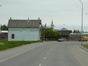
and this interesting building or ten near High River.
We continued north on Hwy 2 and drove on the east side of Calgary and then on the Beddington Trail to the north side of Calgary where we saw housing areas built up on the hills around Calgary. The housing developments extended as far as we could see - talk about urban sprawl! But the houses are really nice looking and some are quite large. Some have almost no space between homes and others have large lawns.
We arrived at Symon's Valley RV Park at 2:30 and the office was closed! Mike called the phone number on the office door and got voice mail. He saw a couple of men at the park and they said to just walk around and find a site and register later. It had been raining here and the roads inside the park were muddy. Mike called me while he was looking for a site and said the place was a mess - there was mud everywhere.
While Mike was looking for a decent campsite, I was trying to find an alternative campground nearby. Mike eventually found a site that would do and we pulled the RV into it.
We are in site #112 and have 30 amp electric with water and sewer. There is free wi-fi here - it isn't a strong signal, but it is adequate. Mike put blocks under the jacks to keep them from sinking into the mud under the RV. Tomorrow we'll see if anyone is in the office so we can register. This is a Passport America campground and the cost if half-price.
We stopped at the St. Mary Gas Station to top off the tank in the RV and paid $3.999 a gallon. We also stopped at the St. Mary Supermarket to get some propane in our on board tank and found out that they had run out of propane. We hitched up the car to the RV there and headed north on US-89 to the U.S.-Canadian border. We again tried to call the Symon's Valley RV Park where we're planning to stay tonight and only get voice mail.
We passed through the small town of Babb and saw this large log house.
 |
| From Montana to Calgary |
We arrived at the Canadian border at 9:45 and were the only ones crossing into Canada.
 |
| From Montana to Calgary |
We handed our passports to the border officer and she asked us the usual questions - purpose for entering Canada, where was our residence, any alcohol & tobacco and how much, any firearms, what our occupations were, and did we have any items we were planning to sell in Canada. She also wanted to know if we had spoken with an immigration officer on our 2 previous visits to Canada. On our first visit to Canada we had to go inside and spoke with an officer and he entered our information in the computer, but we didn't know if he had been an immigration officer. She handed back our passports along with a yellow paper and instructed us where to park our RV and that we were to come inside and talk with an immigration officer.
Once inside we handed over our passports again (& the yellow paper) and he asked us if we had ever been to court or convicted of a felony. He asked some of the same questions the other officer had asked and then entered our passport information in the computer. After a few minutes he handed back our passports and wished us a pleasant trip.
We headed north on Highway 2 and passed through some small towns on our way to Calgary. We drove through Cardston and saw a Fay Wray Fountain (we did get a photo of the sign for the fountain).
 |
| From Montana to Calgary |
We saw this gas station in Cardston $1.219 for regular. Not bad, but that is for a liter and that works out to $4.614 a gallon (that's not accounting for the currency exchange rate).
 |
| From Montana to Calgary |
We stopped at a pull-off about 25 miles north of Cardston for and early lunch at 11:00.
We then drove through Fort MacLeod and decided to drive on the historic Main Street instead of the truck route
 |
| From Montana to Calgary |
and if we had taken the truck route we would have gone by the reconstruction of Fort MacLeod which is now the Museum for the North-West Mounted Police.
 |
| From Montana to Calgary |
We saw this gas station in Claresholm and the gas is lower here - $1.154 a liter ($4.368 a gallon)
 |
| From Montana to Calgary |
and saw these familiar businesses
 |
| From Montana to Calgary |
and this cute drive-in.
 |
| From Montana to Calgary |
We saw the Happy Face Equestrian Farm near Nanton
 |
| From Montana to Calgary |
and this interesting building or ten near High River.
 |
| From Montana to Calgary |
We continued north on Hwy 2 and drove on the east side of Calgary and then on the Beddington Trail to the north side of Calgary where we saw housing areas built up on the hills around Calgary. The housing developments extended as far as we could see - talk about urban sprawl! But the houses are really nice looking and some are quite large. Some have almost no space between homes and others have large lawns.
 |
| From Montana to Calgary |
We arrived at Symon's Valley RV Park at 2:30 and the office was closed! Mike called the phone number on the office door and got voice mail. He saw a couple of men at the park and they said to just walk around and find a site and register later. It had been raining here and the roads inside the park were muddy. Mike called me while he was looking for a site and said the place was a mess - there was mud everywhere.
 |
| From Montana to Calgary |
While Mike was looking for a decent campsite, I was trying to find an alternative campground nearby. Mike eventually found a site that would do and we pulled the RV into it.
 |
| From Montana to Calgary |
 |
| From Montana to Calgary |
We are in site #112 and have 30 amp electric with water and sewer. There is free wi-fi here - it isn't a strong signal, but it is adequate. Mike put blocks under the jacks to keep them from sinking into the mud under the RV. Tomorrow we'll see if anyone is in the office so we can register. This is a Passport America campground and the cost if half-price.
Tuesday, July 14, 2009
Trowbridge Falls Campground
It was 37°F (3°C) this morning. I went into Walmart to do some grocery shopping before we headed over to Trowbridge Falls Campground. We spent the morning trying to call Al & Symphony to let them know about our change in plans on campgrounds, but our calls weren't getting through to them. After lunch we decided to go to Trowbridge Falls Campground, a Thunder Bay city campground, and get our campsites.
Mike called the office at Chippewa Park to leave a message for Al to let them know about the change in plans just in case we weren't able to call them.
It was only 7 miles from Walmart to the campground and we arrived there about 2:30. We both went into the office at the campground and had a great time visiting with the 2 ladies, Dolly & Barb, who work there. They both had a great attitude and were very funny. We also left a message for Al with them in case he should call.
We paid $125.70 CAD ($111.65 US) for 5 days. We are in site 36A - it is a double site with 30amp (36B) & 50amp (36A) electric service. The sites are gravel with electric and water hookups. The bathrooms/showers and dump station are across from our sites and there is a nice grassy area next to the bathrooms to walk the dogs.
It did warm up to 72°F (22°C) this afternoon and we had a little bit of rain
Mike called the office at Chippewa Park to leave a message for Al to let them know about the change in plans just in case we weren't able to call them.
It was only 7 miles from Walmart to the campground and we arrived there about 2:30. We both went into the office at the campground and had a great time visiting with the 2 ladies, Dolly & Barb, who work there. They both had a great attitude and were very funny. We also left a message for Al with them in case he should call.
We paid $125.70 CAD ($111.65 US) for 5 days. We are in site 36A - it is a double site with 30amp (36B) & 50amp (36A) electric service. The sites are gravel with electric and water hookups. The bathrooms/showers and dump station are across from our sites and there is a nice grassy area next to the bathrooms to walk the dogs.
 |
| From Ontario |
It did warm up to 72°F (22°C) this afternoon and we had a little bit of rain
Monday, July 13, 2009
Marathon to Thunder Bay
It was cooler this morning when we got up - 39°F (4°C), but since it was sunny it didn't feel too cold. We left Neys Lunch & Campground this morning around 10:30 and headed west on Trans Canada 17.
We stopped for lunch about noon at a pull-off east of Kama overlooking Lake Superior.
While we were stopped for lunch, Mike called American Home Base to have our mail sent to Grand Portage, Minnesota which is about 40 miles south of Thunder Bay. If we have our mail sent to us in Canada it has to go through customs and there is no telling when we would actually receive it.
We pulled into the Terry Fox Tourist Information Centre around 2 p.m. After picking up some brochures at the Information Centre we walked over to the Terry Fox Monument which overlooks Lake Superior. The monument is set on a 45 ton granite base with a foundation of local amethyst and a 9 foot high bronze statue of Terry Fox on top. Terry Fox lost a leg to cancer at the age of 20 and embarked on a cross-country run for Cancer research - Marathon of Hope. Unfortunately on September 1, 1980 just northeast of Thunder Bay after 143 days, running 5,373 km (3,339 miles) he was unable to finish because his cancer had spread.
We then drove into Thunder Bay to locate Wal-Mart where we're spending the night. After parking the RV at Wal-Mart we disconnected the Vue and drove south to Chippewa Park to check out the campground there. We found out that they are in the process of updating the campground, so we decided to drive up to Trowbridge Falls Park & Campground to see what they have there. After driving up to Trowbridge Falls Campground and looking around, we decided to stay there.
Before heading back to the RV, we stopped at a Wendy's for dinner and then at Robin's Donuts for some donuts.
We drove about 170 miles today from Neys Campground. Al and Symphony are supposed to be here tomorrow. We do have 1 bar on our cell phones here in Thunder Bay, but we haven't been able to call Al to let them know that we're staying at Trowbridge Falls instead of Chippewa Park.
We stopped for lunch about noon at a pull-off east of Kama overlooking Lake Superior.
 |
| From Ontario |
While we were stopped for lunch, Mike called American Home Base to have our mail sent to Grand Portage, Minnesota which is about 40 miles south of Thunder Bay. If we have our mail sent to us in Canada it has to go through customs and there is no telling when we would actually receive it.
We pulled into the Terry Fox Tourist Information Centre around 2 p.m. After picking up some brochures at the Information Centre we walked over to the Terry Fox Monument which overlooks Lake Superior. The monument is set on a 45 ton granite base with a foundation of local amethyst and a 9 foot high bronze statue of Terry Fox on top. Terry Fox lost a leg to cancer at the age of 20 and embarked on a cross-country run for Cancer research - Marathon of Hope. Unfortunately on September 1, 1980 just northeast of Thunder Bay after 143 days, running 5,373 km (3,339 miles) he was unable to finish because his cancer had spread.
 |
| From Ontario |
We then drove into Thunder Bay to locate Wal-Mart where we're spending the night. After parking the RV at Wal-Mart we disconnected the Vue and drove south to Chippewa Park to check out the campground there. We found out that they are in the process of updating the campground, so we decided to drive up to Trowbridge Falls Park & Campground to see what they have there. After driving up to Trowbridge Falls Campground and looking around, we decided to stay there.
Before heading back to the RV, we stopped at a Wendy's for dinner and then at Robin's Donuts for some donuts.
We drove about 170 miles today from Neys Campground. Al and Symphony are supposed to be here tomorrow. We do have 1 bar on our cell phones here in Thunder Bay, but we haven't been able to call Al to let them know that we're staying at Trowbridge Falls instead of Chippewa Park.
Sunday, July 5, 2009
Sault Ste. Marie to Wawa, ON
It wasn’t quite as cold this morning when we got up (41ºF which is 5ºC) as yesterday morning. We left Glenview Campground this morning about 10:00 and headed north on Trans Canada Highway 17.
About 11:00 we stopped at Batchawana Bay Provincial Park. It is a day use park on the shores of Lake Superior. We found a picnic table right on the bay and decided that this was a great place to have lunch. Symphony and I made lunch and we carried it out to the picnic table. I doubt we could have found a better place to have lunch - sometimes spur of the moment stops turn out to be the best ones!
After lunch we continued north on TC-17 to Wawa, Ontario. After traveling 133 miles from Glenview Campground in Sault Ste Marie, we arrived at Wawa RV Resort & Campground around 2 p.m.
We are in site #6 and have water and electric (30 amp) hookups. We are staying here with a Good Sam discount, so it is $28.75 CAD ($26.05 US) a day. Mike had to use bungee cords to hold the electric cord in the socket, since the socket was installed upside down..
Site #6 is a back-in gravel site with grass and it is fairly level; however there isn't enough room to put our awning out because of the trees next to us. Al and Symphony are next to us in site #5. Even though we're in a back-in site, we've driven the RV forward in the site so our door faces Al and Symphony's door - much easier for visiting back and forth.
We have wifi here, but I'm not able to pick up the signal. Symphony can pick up the wifi signal in their RV - I think it's because of the way their RV is facing. There is a small building at the entrance with a public phone and a desk with chairs and we are able to pick up the wifi signal there. We have no Verizon cell phone service here, fortunately we have a phone card.
We had light rain this afternoon and our high for the day was 55º (13ºC).
About 11:00 we stopped at Batchawana Bay Provincial Park. It is a day use park on the shores of Lake Superior. We found a picnic table right on the bay and decided that this was a great place to have lunch. Symphony and I made lunch and we carried it out to the picnic table. I doubt we could have found a better place to have lunch - sometimes spur of the moment stops turn out to be the best ones!
 |
| From Ontario |
After lunch we continued north on TC-17 to Wawa, Ontario. After traveling 133 miles from Glenview Campground in Sault Ste Marie, we arrived at Wawa RV Resort & Campground around 2 p.m.
We are in site #6 and have water and electric (30 amp) hookups. We are staying here with a Good Sam discount, so it is $28.75 CAD ($26.05 US) a day. Mike had to use bungee cords to hold the electric cord in the socket, since the socket was installed upside down..
Site #6 is a back-in gravel site with grass and it is fairly level; however there isn't enough room to put our awning out because of the trees next to us. Al and Symphony are next to us in site #5. Even though we're in a back-in site, we've driven the RV forward in the site so our door faces Al and Symphony's door - much easier for visiting back and forth.
 |
| From Ontario |
We have wifi here, but I'm not able to pick up the signal. Symphony can pick up the wifi signal in their RV - I think it's because of the way their RV is facing. There is a small building at the entrance with a public phone and a desk with chairs and we are able to pick up the wifi signal there. We have no Verizon cell phone service here, fortunately we have a phone card.
 |
| From Ontario |
We had light rain this afternoon and our high for the day was 55º (13ºC).
4th of July Fireworks
It was much colder this morning when we got up – 39º (4ºC).
We were in Gaylord, MI on July 1 and missed Canada’s 142nd birthday (Canada Day) which they celebrate with fireworks and various activities.
We drove down to the St. Mary’s River waterfront near the Station Mall in Sault Ste Marie, Ontario about 7:30 to watch the 4th of July fireworks. There is a riverside park along the St. Mary’s River and we found benches to sit on while we waited for the fireworks display to start at dusk. Did I mention when dusk was??? How about 9:30!
The 4 of us sat on the bench and watched the crowd around us get larger as it got later in the evening. Even though it had warmed up to 77º (25º C) this afternoon, it was chilly sitting on the waterfront waiting for the fireworks to begin.
What can I say – the fireworks were terrific. Mike took movies of the fireworks with our digital camera and I was able to get some still snapshots from the movies that came out pretty good.
I overheard one girl standing near me who said that the U.S. fireworks were better than the Canadian ones. Since we didn’t see the Canadian ones, we’ll happily take her word for it.
It was nearly midnight by the time we got back to the campground.
We were in Gaylord, MI on July 1 and missed Canada’s 142nd birthday (Canada Day) which they celebrate with fireworks and various activities.
We drove down to the St. Mary’s River waterfront near the Station Mall in Sault Ste Marie, Ontario about 7:30 to watch the 4th of July fireworks. There is a riverside park along the St. Mary’s River and we found benches to sit on while we waited for the fireworks display to start at dusk. Did I mention when dusk was??? How about 9:30!
The 4 of us sat on the bench and watched the crowd around us get larger as it got later in the evening. Even though it had warmed up to 77º (25º C) this afternoon, it was chilly sitting on the waterfront waiting for the fireworks to begin.
 |
| From Sault Ste Marie |
What can I say – the fireworks were terrific. Mike took movies of the fireworks with our digital camera and I was able to get some still snapshots from the movies that came out pretty good.
 |
| From Sault Ste Marie |
I overheard one girl standing near me who said that the U.S. fireworks were better than the Canadian ones. Since we didn’t see the Canadian ones, we’ll happily take her word for it.
It was nearly midnight by the time we got back to the campground.
Friday, July 3, 2009
Soo Locks Tour
It was 50º F (10º C) and cloudy when we got up this morning. We spent the morning going through the travel brochures for area and planning where we wanted to go sightseeing.
We learned from the brochures that Sault Ste. Marie, MI is the oldest city in Michigan and the third oldest city in the United States. French missionaries and fur traders ventured into the territory in the 1600’s. Father Jacques Marquette, the legendary Jesuit missionary and explorer, named the European settlement Sault Ste. Marie in honor of the Virgin Mary. The French and British often fought over the area in the 1700’s. In 1820 the Treaty of Sault was signed and control of the area south of the St. Mary’s River was turned over to the United States in 1823. The Twin cities of Sault Ste. Marie, Michigan and Sault Ste. Marie, Ontario are called the Twin Sault area – an International City.
After lunch we drove across the International Bridge ($5 toll) and crossed the border into the U.S. to Sault Ste. Marie, MI to go on the Soo Locks Boat Tour. We arrived at Dock #2 and purchased tickets ($21 each) for the 1:45 p.m. boat tour. When the tour boat arrived we boarded the Nokomis and took our seats in the forward seating area. It was still cloudy and the temp was in the mid 50’s, so we definitely needed our coats.
On our 2 hour boat tour of the Soo Locks we passed by the Edison Building – a quarter mile long horizontal shaft hydro plant (the longest in the world), built from 1898 to 1902. We saw the Algoma Steel Plant, the Museum Ship “Valley Camp”, Canadian Bushplane Museum, M.S. Norgoma Museum Ship, and the Tower of History.
On our tour we learned that the American Soo Locks are a designated National Historic Site. The first lock was constructed in the late 1700’s on the Canadian side of the river, but was destroyed during the War of 1812. The federal government took control of the modernized locks in the 1870’s. The Soo Locks are the busiest locks in the world. The two active U.S. locks are the MacArthur and the Poe and they handle an average of 10,000 vessel passages a year.
After our boat tour we bought some postcards at the gift shop and got a couple of Mocha Cappuccinos at the Dockside Cafe to help us warm up.
Before heading back to the RV park we drove down to the Aune Osborne Campground to check it out and stopped at a couple of places to take photos. We also stopped at The Totem Pole souvenir shop north of Sault Ste. Marie in Ontario to take photos of the Man and Moose.
After dinner Symphony and I went up to the common room with our laptops to use their wifi service. Since it's still early in the season, we were the only ones up there.
We learned from the brochures that Sault Ste. Marie, MI is the oldest city in Michigan and the third oldest city in the United States. French missionaries and fur traders ventured into the territory in the 1600’s. Father Jacques Marquette, the legendary Jesuit missionary and explorer, named the European settlement Sault Ste. Marie in honor of the Virgin Mary. The French and British often fought over the area in the 1700’s. In 1820 the Treaty of Sault was signed and control of the area south of the St. Mary’s River was turned over to the United States in 1823. The Twin cities of Sault Ste. Marie, Michigan and Sault Ste. Marie, Ontario are called the Twin Sault area – an International City.
After lunch we drove across the International Bridge ($5 toll) and crossed the border into the U.S. to Sault Ste. Marie, MI to go on the Soo Locks Boat Tour. We arrived at Dock #2 and purchased tickets ($21 each) for the 1:45 p.m. boat tour. When the tour boat arrived we boarded the Nokomis and took our seats in the forward seating area. It was still cloudy and the temp was in the mid 50’s, so we definitely needed our coats.
 |
| From Sault Ste Marie |
On our 2 hour boat tour of the Soo Locks we passed by the Edison Building – a quarter mile long horizontal shaft hydro plant (the longest in the world), built from 1898 to 1902. We saw the Algoma Steel Plant, the Museum Ship “Valley Camp”, Canadian Bushplane Museum, M.S. Norgoma Museum Ship, and the Tower of History.
 |
| From Sault Ste Marie |
On our tour we learned that the American Soo Locks are a designated National Historic Site. The first lock was constructed in the late 1700’s on the Canadian side of the river, but was destroyed during the War of 1812. The federal government took control of the modernized locks in the 1870’s. The Soo Locks are the busiest locks in the world. The two active U.S. locks are the MacArthur and the Poe and they handle an average of 10,000 vessel passages a year.
After our boat tour we bought some postcards at the gift shop and got a couple of Mocha Cappuccinos at the Dockside Cafe to help us warm up.
Before heading back to the RV park we drove down to the Aune Osborne Campground to check it out and stopped at a couple of places to take photos. We also stopped at The Totem Pole souvenir shop north of Sault Ste. Marie in Ontario to take photos of the Man and Moose.
 |
| From Sault Ste Marie |
After dinner Symphony and I went up to the common room with our laptops to use their wifi service. Since it's still early in the season, we were the only ones up there.
Thursday, July 2, 2009
Gaylord, MI to Sault Ste. Marie, Ontario
This morning we broke camp and drove the RV’s over to the dump station to empty our holding tanks. Mike changed out the sediment filter before putting some water in the fresh water tank. While Mike was doing that, I drove the car to Johnson’s Propane to have our portable propane tank filled. I paid $2.49 a gallon for the propane plus a $7 labor fee (the first time we’ve been charged a fee for filling the tank).
Mike and I met Symphony and Al at Wal-Mart Supercenter and after hitching up the cars, we were on our way to Canada via I-75. It was 66 miles from Gaylord up to the Mackinac Bridge. We crossed the Mackinac Bridge about 11:30 a.m. and paid a toll of $10.00 ($3 car, $7 RV) at the toll booth at St. Ignace, MI. After crossing into St. Ignace we drove past Castle Rock which we had climbed June 15 when we went on the Mackinaw Trolley Tour.
We stopped for gas at a Citgo station in Sault Ste. Marie, MI where we filled the tanks in the RV and car ($2.759 gallon) before crossing the border into Ontario. We were charged a $10 toll to cross the International Bridge. The border between the U.S. and Canada is halfway across the International Bridge where I-75 becomes Hwy 17B. Once we crossed into Ontario we had about a 15 minute wait before going through Canadian Customs.
After answering the usual questions regarding the purpose of our trip into Canada, we were on our way. There was currency exchange office just past Customs and we stopped there to change some U.S. currency into Canadian. The exchange rate was $1 U.S. to $1.10 Canadian. Then we stopped at the Ontario Travel Information Centre to pick up brochures. They also had a currency exchange service there. Mike checked on the exchange rate there and we would have been better off getting our Canadian money there. Oh well, live and learn!
We arrived at Glenview Cottages and Campground about 4:30 this afternoon - 130 miles from Gaylord, MI. We are in site #58 which is a pull-through and we have electric (30 amp) and water. Al and Symphony are next to us in site 59. We will be here for 3 days and are paying $31.19 Canadian Dollar (CAD) a day - $27.18 US Dollar. We have wifi in the campground, but we'll will have to go up to the office/common room.
Mike and I met Symphony and Al at Wal-Mart Supercenter and after hitching up the cars, we were on our way to Canada via I-75. It was 66 miles from Gaylord up to the Mackinac Bridge. We crossed the Mackinac Bridge about 11:30 a.m. and paid a toll of $10.00 ($3 car, $7 RV) at the toll booth at St. Ignace, MI. After crossing into St. Ignace we drove past Castle Rock which we had climbed June 15 when we went on the Mackinaw Trolley Tour.
 |
| From Entering Ontario |
We stopped for gas at a Citgo station in Sault Ste. Marie, MI where we filled the tanks in the RV and car ($2.759 gallon) before crossing the border into Ontario. We were charged a $10 toll to cross the International Bridge. The border between the U.S. and Canada is halfway across the International Bridge where I-75 becomes Hwy 17B. Once we crossed into Ontario we had about a 15 minute wait before going through Canadian Customs.
 |
| From Entering Ontario |
After answering the usual questions regarding the purpose of our trip into Canada, we were on our way. There was currency exchange office just past Customs and we stopped there to change some U.S. currency into Canadian. The exchange rate was $1 U.S. to $1.10 Canadian. Then we stopped at the Ontario Travel Information Centre to pick up brochures. They also had a currency exchange service there. Mike checked on the exchange rate there and we would have been better off getting our Canadian money there. Oh well, live and learn!
We arrived at Glenview Cottages and Campground about 4:30 this afternoon - 130 miles from Gaylord, MI. We are in site #58 which is a pull-through and we have electric (30 amp) and water. Al and Symphony are next to us in site 59. We will be here for 3 days and are paying $31.19 Canadian Dollar (CAD) a day - $27.18 US Dollar. We have wifi in the campground, but we'll will have to go up to the office/common room.
 |
| From Sault Ste Marie |
Monday, June 30, 2008
Saint-Alexandre-de-Kamouraska to Granby, Québec
We left Camping le Rayon de Soliel this morning at 9:15. We continued on TC-20 still following the St. Lawrence River.
One of the road signs we saw along the way was this one warning of a rough road ahead and they were right.
After about 150 miles we stopped at a rest area at the Villeroy Halte Routière (Villeroy Rest Area) at 12:30 p.m. for a 30 minute lunch break.
Then back on TC-20 until we reach Exit 141 were we take Rte 116 north of Sainte-Rosalie for about 4 miles. We then took Rte 224 at Sainte-Rosalie for about 2 miles to Rte 137 south of Sainte-Hyacinthe,
then Rte 137 for 18 miles to Rte 112 west of Granby and another 1½ miles to Camping Tropicana. We arrived here around 3 p.m.
Camping Tropicana is a Passport America campground. We're paying $19 for our 1 night stay here. We are in site #714. Yes, you read that correctly - site #714 - this place is HUGE! There are 880 RV sites here. There are a lot (I mean a LOT) of permanent RVs here. There is a lake with a nice beach, paddle boats for rent, mini golf and much more. This is definitely a destination campground for families with a lot of activities and planned events.
Site #714 is one of 25 pull-through sites. We have full hook-ups (30 amp); the electric voltage and water pressure is low. We were guided to our campsite and didn't plan on disconnecting the Vue since we're only staying for tonight. When we pulled into the site, we ended up with the Vue sticking out in the roadway. When we tried to disconnect the car, we couldn't because the hitch was at such an angle that it was impossible to get the pins out. Mike wanted to pull forward so we could straighten the hitch out, but our guide was hesitant for us to do that.
Fortunately the owner, Gilles Savoie, came by on his bicycle. He had Mike pull the RV forward so we could disconnect the car. Then Mike backed the RV into the site so it was in there at a better angle. We then hitched the car back up and it wasn't sticking out in the road. Gilles was extremely helpful and knowledgeable about straightening out (no pun intended) our situation. He was also about the only person we've met here that speaks English. Maybe I should have taken French in high school instead of Spanish!
We found out why Gilles knew so much about RVs and spoke such good English - he is a motorhome owner. Mike asked him about the amount of snow that Granby has during the winter (the campground is closed then) and Gilles said he didn't know! He said he takes his motorhome and travels south to the US during the Canadian winter. He said he not only doesn't know how much snow is there in Granby, he doesn't care since he's enjoying the warmer weather in the south. He keeps his motorhome at the north end of Lake Champlain when he's not out traveling during the winter.
One of the road signs we saw along the way was this one warning of a rough road ahead and they were right.
 |
| From Quebec |
After about 150 miles we stopped at a rest area at the Villeroy Halte Routière (Villeroy Rest Area) at 12:30 p.m. for a 30 minute lunch break.
 |
| From Quebec |
Then back on TC-20 until we reach Exit 141 were we take Rte 116 north of Sainte-Rosalie for about 4 miles. We then took Rte 224 at Sainte-Rosalie for about 2 miles to Rte 137 south of Sainte-Hyacinthe,
 |
| From Quebec |
then Rte 137 for 18 miles to Rte 112 west of Granby and another 1½ miles to Camping Tropicana. We arrived here around 3 p.m.
Camping Tropicana is a Passport America campground. We're paying $19 for our 1 night stay here. We are in site #714. Yes, you read that correctly - site #714 - this place is HUGE! There are 880 RV sites here. There are a lot (I mean a LOT) of permanent RVs here. There is a lake with a nice beach, paddle boats for rent, mini golf and much more. This is definitely a destination campground for families with a lot of activities and planned events.
Site #714 is one of 25 pull-through sites. We have full hook-ups (30 amp); the electric voltage and water pressure is low. We were guided to our campsite and didn't plan on disconnecting the Vue since we're only staying for tonight. When we pulled into the site, we ended up with the Vue sticking out in the roadway. When we tried to disconnect the car, we couldn't because the hitch was at such an angle that it was impossible to get the pins out. Mike wanted to pull forward so we could straighten the hitch out, but our guide was hesitant for us to do that.
Fortunately the owner, Gilles Savoie, came by on his bicycle. He had Mike pull the RV forward so we could disconnect the car. Then Mike backed the RV into the site so it was in there at a better angle. We then hitched the car back up and it wasn't sticking out in the road. Gilles was extremely helpful and knowledgeable about straightening out (no pun intended) our situation. He was also about the only person we've met here that speaks English. Maybe I should have taken French in high school instead of Spanish!
We found out why Gilles knew so much about RVs and spoke such good English - he is a motorhome owner. Mike asked him about the amount of snow that Granby has during the winter (the campground is closed then) and Gilles said he didn't know! He said he takes his motorhome and travels south to the US during the Canadian winter. He said he not only doesn't know how much snow is there in Granby, he doesn't care since he's enjoying the warmer weather in the south. He keeps his motorhome at the north end of Lake Champlain when he's not out traveling during the winter.
Sunday, June 29, 2008
Woodstock, New Brunswick to Saint-Alexandre-de-Kamouraska, Quebec
We departed Cosy Cabins Campground at 10 a.m. still driving north on Trans Canada Hwy-2. We stopped at an Ultramar gas station at Perth-Andover to get gas for the RV. We got 210.523 liters for $1.406 a liter (55.631 gallons for $5.321 a gallon US).
TC-2 became Trans Canada Hwy-185 when we entered Québec and we entered the Eastern Time Zone.
We stopped at a rest area near Dégelis, Québec for lunch. After about a 30 minute lunch break, we continued west to the St. Lawrence River and drove south on Trans Canada Hwy-20.
After about 8 miles we took exit 488 to Camping le Rayon de Soliel. We drove a total of 193 miles today.
Camping le Rayon de Soliel gives a 10% discount for Good Sam. We are in site #27 with full hook-ups (30 amp). The water pressure is low and the electric voltage is low also. Site 27 is a grassy pull-through site with lots of trees and the roads in the campground are narrow. We do have wifi, but no satellite TV reception. We are able to pick up local TV stations on the antenna, but they are all in French - of course! Looks like another DVD movie night.
 |
| From Quebec |
TC-2 became Trans Canada Hwy-185 when we entered Québec and we entered the Eastern Time Zone.
 |
| From Quebec |
We stopped at a rest area near Dégelis, Québec for lunch. After about a 30 minute lunch break, we continued west to the St. Lawrence River and drove south on Trans Canada Hwy-20.
 |
| From Quebec |
After about 8 miles we took exit 488 to Camping le Rayon de Soliel. We drove a total of 193 miles today.
Camping le Rayon de Soliel gives a 10% discount for Good Sam. We are in site #27 with full hook-ups (30 amp). The water pressure is low and the electric voltage is low also. Site 27 is a grassy pull-through site with lots of trees and the roads in the campground are narrow. We do have wifi, but no satellite TV reception. We are able to pick up local TV stations on the antenna, but they are all in French - of course! Looks like another DVD movie night.
Saturday, June 28, 2008
Amherst, Nova Scotia to Woodstock, New Brunswick
We left Gateway Parklands Campground about 10:15 this morning. Just down the road from the campground we saw this firewood stacked near a house.
We crossed the border into New Brunswick less than a mile after leaving the campground. Hwy-104 becomes Trans Canada Hwy-2 in New Brunswick. We drove back through Moncton and on to Woodstock, New Brunswick on Trans Canada Hwy-2. TC-2 followed the course of the St. John River through New Brunswick. We had some great views of the St. John River at various places along the highway.
We exited TC-2 at Exit 191 and drove east to Hwy-165 and there was Cosy Cabins Campground. Cosy Cabins is a Passport America campground. We are on site #3. It is a pull-through and we have full hook-ups with 50 amp service and wifi. These are gravel sites with some grass and are pretty level. The regular fee is $30 a night and with tax we're paying $16.39 with Passport America.
But the view alone is worth staying here! We are facing the St. John River with nothing to obstruct our view. This afternoon while I was walking Tinker we startled a beaver that had come up near the campground.
Now we wish that we had allowed more time to stay here at Cosy Cabins. We've learned that Woodstock is New Brunswick's first town and was incorporated in 1856 and has many Victorian properties on a local historic register. We won't have time to see them before we leave tomorrow - another reason to come back this way another time.
 |
| From Leaving the Maritimes |
We crossed the border into New Brunswick less than a mile after leaving the campground. Hwy-104 becomes Trans Canada Hwy-2 in New Brunswick. We drove back through Moncton and on to Woodstock, New Brunswick on Trans Canada Hwy-2. TC-2 followed the course of the St. John River through New Brunswick. We had some great views of the St. John River at various places along the highway.
 |
| From Leaving the Maritimes |
We exited TC-2 at Exit 191 and drove east to Hwy-165 and there was Cosy Cabins Campground. Cosy Cabins is a Passport America campground. We are on site #3. It is a pull-through and we have full hook-ups with 50 amp service and wifi. These are gravel sites with some grass and are pretty level. The regular fee is $30 a night and with tax we're paying $16.39 with Passport America.
 |
| From Leaving the Maritimes |
But the view alone is worth staying here! We are facing the St. John River with nothing to obstruct our view. This afternoon while I was walking Tinker we startled a beaver that had come up near the campground.
 |
| From Leaving the Maritimes |
Now we wish that we had allowed more time to stay here at Cosy Cabins. We've learned that Woodstock is New Brunswick's first town and was incorporated in 1856 and has many Victorian properties on a local historic register. We won't have time to see them before we leave tomorrow - another reason to come back this way another time.
Friday, June 27, 2008
Badddeck to Amherst, Nova Scotia
We left Adventures East Campground this morning around 10:15. We retraced our route along Hwy-105 to Hwy-104. We paid another $5.25 toll at the Cobequid Pass Toll Plaza. We stopped at an Irving gas station in Antigonish to fill the RV tank. We bought 208.1 liters for $1.431 a liter (54.99 gallons at $5.416 a gallon). While we were there we found a place to park the RV and fix lunch.
We continued north on Hwy-104 to Amherst. We stopped at a Sobey's grocery store there to stock up on groceries before going on to Gateway Parklands Campground which is just 5 miles north of there. The distance from Adventures East Campground to Gateway Parklands Campground was 219 miles.
We arrived here at Gateway Parklands Campground a little after 4 p.m. Gateway Parklands is a Passport America campground, but the discount is good for a minimum and maximum of a 2 night stay and we're only staying tonight. The manager gave us a discount for paying in cash which came to $25 - the discount price for Passport America would have been $14 (cash) a night. If we hadn't already made reservations up the road in New Brunswick and Quebec, we could have stayed for 2 nights.
We are on site #W5, a pull-through, with full hook-ups (30 amp). We have good electric voltage, but the water pressure is low. Some of the sites have concrete pads, but we are on a grass site and it is fairly level. We have satellite TV reception finally.
Wednesday, June 25, 2008
Alexander Graham Bell National Historic Site of Canada
We visited the Alexander Graham Bell National Historic Site at the east end of Baddeck. The entrance fee for seniors was $6.55 each.
The museum is divided into several exhibit areas. The first one we saw was "Sound & Silence" which tells of his life from birth in Scotland in 1847 up to his arrival in Baddeck in 1885. Bell's mother was deaf and his father taught the deaf to speak. Mabel Hubbard Bell developed scarlet fever at the age of five and spread to her inner ears and she became totally deaf. We learned of Alexander Graham Bell's work teaching deaf people and saw photos of him with Helen Keller and Annie Sullivan.
Our next stop was to the Mr. Bell theater where we watched an 18 minute showing films, photographs and artifacts to see the ideas that led Bell to create man-carrying kites, airplanes and a marine record-setting hydrofoil boat.
We then went into the "Water" exhibit which tells the story of Bell's and Casey Baldwin's experiments with hydrofoil craft. There we saw the remains of the successful HD-4 hydrofoil. There was also a full-size recreation of the hydrofoil. On September 9, 1919 his hydrofoil boat HD-4 (his fourth hydrofoil boat) set a world's marine speed record of 70.86 mph - the record stood for 10 years.
Our next stop was at the "Air" exhibit told of Bell's work with man-carrying kites and airplanes. We saw some original parts from his "Silver Dart" airplane. On February 23, 1909 his "Silver Dart" made the first controlled, powered flight in Canada and the British Empire. It's engine was supplied by Glenn Curtiss. The "Silver Dart' crashed on its fifth flight and never flew again.
In the "Ideas" exhibit we saw the wide range of experiments and interest of Bell and his associates. Bell was fascinated with tetrahedral shapes and used them as the basis for his kites. He used the design for his beach cabana which was on the grounds of the museum.
In the "Home" exhibit we learned the story of Bell's estate, Beinn Bhreagh; it means "beautiful mountain" in Scottish Gaelic. We saw photos of Bell and his family. We learned of their family life while living in Baddeck. The Bell home is still in possession of the Bell family and is maintained as a private residence. Alexander Graham Bell died August 2, 1922 at his home in Baddeck. Mabel Hubbard Bell was born November 25, 1857 (10 years younger than Bell) and died at home in Baddeck on January 3, 1923. They are both buried at Beinn Bhreagh.
The museum is divided into several exhibit areas. The first one we saw was "Sound & Silence" which tells of his life from birth in Scotland in 1847 up to his arrival in Baddeck in 1885. Bell's mother was deaf and his father taught the deaf to speak. Mabel Hubbard Bell developed scarlet fever at the age of five and spread to her inner ears and she became totally deaf. We learned of Alexander Graham Bell's work teaching deaf people and saw photos of him with Helen Keller and Annie Sullivan.
 |
| From Alexander Graham Bell Museum |
Our next stop was to the Mr. Bell theater where we watched an 18 minute showing films, photographs and artifacts to see the ideas that led Bell to create man-carrying kites, airplanes and a marine record-setting hydrofoil boat.
We then went into the "Water" exhibit which tells the story of Bell's and Casey Baldwin's experiments with hydrofoil craft. There we saw the remains of the successful HD-4 hydrofoil. There was also a full-size recreation of the hydrofoil. On September 9, 1919 his hydrofoil boat HD-4 (his fourth hydrofoil boat) set a world's marine speed record of 70.86 mph - the record stood for 10 years.
 |
| From Alexander Graham Bell Museum |
Our next stop was at the "Air" exhibit told of Bell's work with man-carrying kites and airplanes. We saw some original parts from his "Silver Dart" airplane. On February 23, 1909 his "Silver Dart" made the first controlled, powered flight in Canada and the British Empire. It's engine was supplied by Glenn Curtiss. The "Silver Dart' crashed on its fifth flight and never flew again.
In the "Ideas" exhibit we saw the wide range of experiments and interest of Bell and his associates. Bell was fascinated with tetrahedral shapes and used them as the basis for his kites. He used the design for his beach cabana which was on the grounds of the museum.
 |
| From Alexander Graham Bell Museum |
In the "Home" exhibit we learned the story of Bell's estate, Beinn Bhreagh; it means "beautiful mountain" in Scottish Gaelic. We saw photos of Bell and his family. We learned of their family life while living in Baddeck. The Bell home is still in possession of the Bell family and is maintained as a private residence. Alexander Graham Bell died August 2, 1922 at his home in Baddeck. Mabel Hubbard Bell was born November 25, 1857 (10 years younger than Bell) and died at home in Baddeck on January 3, 1923. They are both buried at Beinn Bhreagh.
 |
| From Alexander Graham Bell Museum |
Monday, June 23, 2008
June 23
Today we went into Baddeck to the library to wifi. We caught up on our e-mails, did some online banking and researched some areas we'll be visiting.
In addition to the great view out the library's picture window, the Baddeck library also has some antique items on display in the reading room.
After returning to the RV I loaded up our laundry and drove up the hill to the laundromat. They have 4 washers - 3 washers that cost $2 (hot water) & 1 for $1.75 (cold water). The 4 dryers cost 75¢ for 20 minute cycles. It took 3-4 cycles to get our bath towels dry. The laundry was clean and all the machines did work. The laundry is housed in the same building as the showers and baths and they were also clean.
In the photo below you can see the building housing the laundry and showers in the background with the playground next to it.
In addition to the great view out the library's picture window, the Baddeck library also has some antique items on display in the reading room.
 |
| From Baddeck, NS |
After returning to the RV I loaded up our laundry and drove up the hill to the laundromat. They have 4 washers - 3 washers that cost $2 (hot water) & 1 for $1.75 (cold water). The 4 dryers cost 75¢ for 20 minute cycles. It took 3-4 cycles to get our bath towels dry. The laundry was clean and all the machines did work. The laundry is housed in the same building as the showers and baths and they were also clean.
In the photo below you can see the building housing the laundry and showers in the background with the playground next to it.
 |
| From Baddeck, NS |
Sunday, June 22, 2008
The Cabot Trail
We were up early this morning and treated ourselves to breakfast at the Red Barn Restaurant which is owned by Adventures East Campground and is only about 1 minute down Hwy-105 from the campground entrance. We practically had the restaurant to ourselves except for another couple having an early Sunday breakfast.
Before heading out on the Cabot Trail drive, we went back to the RV to pack a picnic lunch and pick up Tinker. The Cabot Trail is named after the explorer John Cabot who landed at Aspy Bay in 1497.
There are 2 different theories on the best way to drive the Cabot Trail. Some say to go north through Baddeck and drive around the island (counterclockwise) with the coast on the passenger side where you have a good view of the change in the landscape. Others say to start at the Red Barn Restaurant (which is at southern entrance) and travel around the island (clockwise) with the coast on the driver's side with a view of the changing coastline. We opted to drive the Cabot Trail in the clockwise direction.
We drove inland to Margaree Forks and then followed the Margaree River to Margaree Harbour and crossed the bridge to Belle Côte. We followed the coast up to Cap Le Moine.
We drove through the scenic villages of Grand Étang, Chéticamp, and Petit Étang where we entered Cape Breton Highlands National Park.
We drove inland through the Highlands to the eastern coast and stopped for a picnic lunch at Black Brook Beach.
After lunch we continued south going through the villages of Ingonish, Ingonish Beach, Wreck Cove, St. Ann's Bay and back into Baddeck. This is truly a beautiful drive and the weather couldn't have been better for our drive. The total distance around the Cabot Trail was 289 kilometers, or 179 miles.
Before heading out on the Cabot Trail drive, we went back to the RV to pack a picnic lunch and pick up Tinker. The Cabot Trail is named after the explorer John Cabot who landed at Aspy Bay in 1497.
There are 2 different theories on the best way to drive the Cabot Trail. Some say to go north through Baddeck and drive around the island (counterclockwise) with the coast on the passenger side where you have a good view of the change in the landscape. Others say to start at the Red Barn Restaurant (which is at southern entrance) and travel around the island (clockwise) with the coast on the driver's side with a view of the changing coastline. We opted to drive the Cabot Trail in the clockwise direction.
We drove inland to Margaree Forks and then followed the Margaree River to Margaree Harbour and crossed the bridge to Belle Côte. We followed the coast up to Cap Le Moine.
 |
| From The Cabot Trail |
We drove through the scenic villages of Grand Étang, Chéticamp, and Petit Étang where we entered Cape Breton Highlands National Park.
 |
| From The Cabot Trail |
 |
| From The Cabot Trail |
 |
| From The Cabot Trail |
After lunch we continued south going through the villages of Ingonish, Ingonish Beach, Wreck Cove, St. Ann's Bay and back into Baddeck. This is truly a beautiful drive and the weather couldn't have been better for our drive. The total distance around the Cabot Trail was 289 kilometers, or 179 miles.
Saturday, June 21, 2008
June 21
We drove into Baddeck today to go to the Baddeck Library to wifi. Baddeck is a picturesque village on Bras d'Or Lake. We stopped at the Baddeck Visitor Center to get brochures on the area.
Baddeck was home to Alexander Graham Bell for many years and The Cabot Trail, a scenic drive, which follows the coast around the northern part of Cape Breton Island. The Alexander Graham Bell National Historic Site of Canada and The Cabot Trail are on our list of sites to see while we're here.
After stopping to shop at a couple of gift shops, we went on to the Baddeck Library. The view from the library's windows have to be the best we've seen to date.
After leaving the library we stopped at the Victoria Farmers Co-op for groceries. On the way back to the campground we stopped at an Ultramar gas station to fill the tank in the Vue. We bought 19.3 liters of gas for $1.466 a liter. After converting into U.S. figures it works out to 5.1 gallons for $5.549 a gallon - Ouch!
When we got back to the RV we found out we had some new neighbors next to us in a Dutch Star. After dinner we got together and build a campfire and swapped travel stories.
One subject was the border crossing into Canada. We told them that after answering the standard questions, we were on our way into Canada. It was a different story when they crossed the border. There were 2 new Canadian Customs Officers who wanted to practice searching a RV and they were the lucky couple!
After about 2-3 hours of emptying the compartments and cabinets and searching everywhere and putting everything back, they were on their way into Canada. They did say that the Customs Officers were very polite and had explained that the only reason they were being searched was for training and practice. I guess it's all in your timing when you cross the border - that is one reason we were up early the morning and crossed into New Brunswick so early. We wanted to allow extra time just in case we were searched.
Baddeck was home to Alexander Graham Bell for many years and The Cabot Trail, a scenic drive, which follows the coast around the northern part of Cape Breton Island. The Alexander Graham Bell National Historic Site of Canada and The Cabot Trail are on our list of sites to see while we're here.
After stopping to shop at a couple of gift shops, we went on to the Baddeck Library. The view from the library's windows have to be the best we've seen to date.
 |
| From Baddeck, NS |
After leaving the library we stopped at the Victoria Farmers Co-op for groceries. On the way back to the campground we stopped at an Ultramar gas station to fill the tank in the Vue. We bought 19.3 liters of gas for $1.466 a liter. After converting into U.S. figures it works out to 5.1 gallons for $5.549 a gallon - Ouch!
When we got back to the RV we found out we had some new neighbors next to us in a Dutch Star. After dinner we got together and build a campfire and swapped travel stories.
 |
| From Baddeck, NS |
One subject was the border crossing into Canada. We told them that after answering the standard questions, we were on our way into Canada. It was a different story when they crossed the border. There were 2 new Canadian Customs Officers who wanted to practice searching a RV and they were the lucky couple!
After about 2-3 hours of emptying the compartments and cabinets and searching everywhere and putting everything back, they were on their way into Canada. They did say that the Customs Officers were very polite and had explained that the only reason they were being searched was for training and practice. I guess it's all in your timing when you cross the border - that is one reason we were up early the morning and crossed into New Brunswick so early. We wanted to allow extra time just in case we were searched.
Subscribe to:
Posts (Atom)